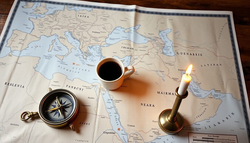
Map of Middle East: Countries, Definitions, and Conflicts
If you’ve ever tried to pin down exactly which countries belong to the Middle East, you’ve probably noticed that no two maps look exactly alike. That’s because the region is less a fixed border and more a shifting geopolitical idea shaped by history, conflict, and perspective.
Countries commonly included: 18 ·
Total area (approx.): 7.2 million sq km ·
Largest country by area: Saudi Arabia (2.15 million sq km) ·
Primary language families: Arabic, Persian, Turkish ·
Major religious groups: Islam (Sunni, Shia), Christianity, Judaism
Quick snapshot
- 18 countries appear in the majority of reference definitions (United Nations Geospatial (official cartographic service))
- Egypt is transcontinental, spanning Africa and Asia via the Sinai Peninsula (National Geographic (geographic education authority))
- The Strait of Hormuz connects the Persian Gulf to the Gulf of Oman (U.S. Energy Information Administration (energy analysis agency))
- The Syrian civil war began in 2011 (Encyclopaedia Britannica (editorial reference))
- The exact number of countries in the Middle East varies by source (Encyclopaedia Britannica (regional definition authority))
- Which regions belong to the “Greater Middle East” versus the “core” is not standardized (WorldAtlas (geographic reference))
- The status of Palestinian territories on official maps differs depending on recognition (United Nations Geospatial (official cartographic service))
- Borders drawn after WWI (Sykes-Picot agreement) continue to shape disputes today (Encyclopaedia Britannica (historical analysis))
- Ongoing civil wars in Syria and Yemen will likely continue to shift de facto control (FrontWatch (conflict monitoring organization))
Key facts about the Middle East
| Attribute | Value |
|---|---|
| Total area (km²) | ≈7,207,575 |
| Population (2024 est.) | ≈465 million |
| Highest point | Mount Damavand, Iran (5,610 m) |
| Lowest point | Dead Sea (−430 m) |
| Largest city | Istanbul, Turkey (≈15.5 million) |
| Primary religion | Islam (≈93% of population) |
The pattern: even basic geographic data points reveal a region defined by extremes — the highest peak, the deepest rift, and the most concentrated urban populations all belong to different countries.
What Countries Are in the Middle East?
Why definitions vary across sources
The term “Middle East” was coined by British colonial strategists in the 19th century, not by geographers. Different organizations include different countries. The United Nations Geospatial (official cartographic service) map includes 18 states, while Encyclopaedia Britannica (editorial authority) lists 17 and excludes Cyprus. The variation stems from whether you emphasize geography, culture, or geopolitics.
Consensus countries
- Bahrain
- Cyprus (sometimes omitted)
- Egypt
- Iran
- Iraq
- Israel
- Jordan
- Kuwait
- Lebanon
- Oman
- Qatar
- Saudi Arabia
- Syria
- Turkey
- United Arab Emirates
- Yemen
These 16 countries appear in nearly every reference list. Afghanistan and Pakistan are sometimes added to a “Greater Middle East” definition, but rarely to the core list (Nations Online Project (geographic portal)).
Why Is the Middle East Map Often Disputed?
Historical colonial borders
The Sykes-Picot Agreement of 1916 carved up Ottoman territories into spheres of influence for Britain and France. Those lines became the borders of modern Syria, Iraq, Jordan, Lebanon, and Palestine. As Encyclopaedia Britannica (historical analysis) notes, the borders ignored ethnic and sectarian divisions, planting seeds of conflict that persist today.
Current territorial conflicts
Kurdistan, Palestine, and Western Sahara have no universally recognized borders. The Syrian civil war (2011–) has created zones of de facto control that no map fully captures. The FrontWatch (conflict monitoring organization) live map shows how front lines shift month by month in Syria, Yemen, and Gaza.
The Middle East map is both the most fixed and the most fluid in the world: fixed on paper by colonial treaties, fluid in reality because those treaties were never designed for the people who live there. The consequence: every published map reflects a political choice its publisher made, whether consciously or not.
How Does the Middle East Fit Geographically with Asia and Africa?
Transcontinental countries: Egypt and Turkey
Egypt lies in both Africa and Asia via the Sinai Peninsula — the Suez Canal is the conventional dividing line. Turkey straddles Europe and Asia, though its cultural and political center of gravity is firmly in West Asia. Both countries are listed in most Middle East references because of their historical and cultural ties to the region (Encyclopaedia Britannica (regional definition authority)).
Relation to the Arabian Plate
The Arabian Peninsula sits on its own tectonic plate, which geologically separates it from the Iranian Plateau and the Anatolian Plate. This physical boundary aligns roughly with the political map: the Red Sea rift and the Zagros mountains mark the plate edges. The Nations Online Project (geographic portal) map shows how the region spans southwestern Asia to northeastern Africa.
The Middle East is not a continent. It is a subset of Asia plus Egypt. That transcontinental identity is why maps sometimes show it as a separate region between Europe, Asia, and Africa — and why definitions always include both landmasses.
Where Is the Strait of Hormuz on a Middle East Map?
Geographic location
The Strait of Hormuz lies between the Persian Gulf to the west and the Gulf of Oman to the east. Iran is on the northern shore; Oman and the United Arab Emirates are to the south. At its narrowest, the strait is only 33 km wide (U.S. Energy Information Administration (energy analysis agency)).
Importance for oil shipping
About 20% of global oil passes through the Strait of Hormuz daily — roughly 21 million barrels per day. Any disruption there directly affects global oil prices. The strait appears on every political and energy map of the Middle East as a chokepoint (U.S. Energy Information Administration (energy analysis agency)).
The implication: the Strait of Hormuz is a single narrow waterway through which a fifth of the world’s oil supply must pass — making it the most strategically valuable 33 kilometers on any Middle East map.
What Are the Major Conflicts Shown on a Middle East Map?
“[The map] is not a static document: it evolves with every ceasefire, every annexation, every peace treaty.”
— United Nations Geospatial map disclaimer (reflecting the provisional nature of boundaries)
Syrian civil war
Since 2011, the Syrian conflict has claimed over 500,000 lives and displaced millions. The map of control zones — government, rebels, Kurds, and ISIS remnants — changes frequently. The FrontWatch (conflict monitoring organization) provides regular updates.
Yemeni civil war
Beginning in 2014, the war between the Houthi movement and the internationally recognized government has created one of the world’s worst humanitarian crises. Control of the capital Sanaa and the port of Hodeidah shifts often (Encyclopaedia Britannica (conflict analysis)).
Israeli-Palestinian conflict
The status of Jerusalem and the borders of a potential Palestinian state remain unresolved. Most UN maps show the 1949 Armistice lines (the Green Line), but Israel’s separation barrier and settlement expansion have redrawn de facto boundaries. The United Nations Geospatial (official cartographic service) map uses dotted lines for these contested areas.
“The Middle East is the world’s most mapped and least understood region — every map is a political statement.”
— Encyclopaedia Britannica entry on the Middle East (editorial overview)
What We Know and What Remains Unclear
Confirmed facts
- 18 countries are included in the majority of reference definitions (United Nations Geospatial (official cartographic service))
- Egypt is transcontinental (National Geographic (geographic education authority))
- Strait of Hormuz is a critical chokepoint for oil transit (U.S. Energy Information Administration (energy analysis agency))
- Syrian civil war began in 2011 (Encyclopaedia Britannica (conflict analysis))
What remains unclear
- Exact number of countries in the Middle East varies by source (Encyclopaedia Britannica (regional definition authority))
- Which regions belong to “Greater Middle East” vs. “core” is not standardized (WorldAtlas (geographic reference))
- Status of Palestinian territories on official maps differs by recognition (United Nations Geospatial (official cartographic service))
How Major Definitions Compare
Three authoritative sources, one pattern: no two sources agree on the exact same list of countries.
| Criterion | United Nations Geospatial | Encyclopaedia Britannica | WorldAtlas |
|---|---|---|---|
| Total countries listed | 18 | 17 | 18 |
| Includes Cyprus | Yes | No | Yes |
| Includes Turkey | Yes | Yes | Yes |
| Includes Egypt | Yes | Yes | Yes |
| Includes Afghanistan | No | No | No (treated as separate) |
The implication: if you’re using a Middle East map, check which definition the publisher follows. The UN map is the most inclusive, Britannica the most conservative, and WorldAtlas splits the difference.
mapsforupsc.com, quia.com, en.wikipedia.org, mideastweb.org, mapsforupsc.com, worldpopulationreview.com, worldatlas.com, nationsonline.org, gisgeography.com
Frequently asked questions
Is the Middle East part of Africa?
No — only Egypt spans both Africa and Asia. The core of the Middle East lies in Western Asia.
Why is the Middle East called the Middle East?
The term originated in British colonial geopolitics in the 19th century to describe the region between Europe and East Asia.
What does the term “MENA” stand for?
Middle East and North Africa — a region that includes the Arab countries of North Africa along with the traditional Middle East.
Is Turkey in the Middle East?
Yes. Turkey is listed in most Middle East references, though it straddles Europe and Asia. Its cultural and political ties place it in the region.
Which is the smallest country in the Middle East?
Bahrain, at about 786 square kilometers.
How many countries in the Middle East have coastlines on the Persian Gulf?
Eight: Iran, Iraq, Kuwait, Saudi Arabia, Bahrain, Qatar, United Arab Emirates, and Oman (via the Gulf of Oman).
What is the oldest country in the Middle East?
Iran, as the modern successor to ancient Persia, has the longest continuous history as a political entity, dating back to the Achaemenid Empire (c. 550 BC).
Is Iran an Arab country?
No. Iran is a Persian country; its official language is Persian (Farsi), not Arabic. Most Iranians are Shia Muslim, while most Arab countries are predominantly Sunni.
For anyone studying the map of the Middle East, the region’s disputed borders are not a flaw — they are its defining feature. Whether you are a student, an analyst, or a curious traveler, the most important skill is to ask: Whose map am I looking at?
More related posts
 I Love You in Spanish: Te Quiero vs Te Amo Explained
 What Is Global Warming? Definition, Causes, and 2050 Predictions
 Blue Lagoon Iceland Christmas Opening Times & Winter Guide
 Cheapest Electricity Supplier Ireland 2026: Compare & Save
 Latest Man Utd News: Ederson Transfer Confirmed, Hojlund Departs
 Weather New York City – Warm Start to Chilly Shift Ahead
 U.S. Open Tee Time 2026: Schedule, TV Channel & Pairing
